Team Members:
Tanner Honnef, Josh Lechtzin, Jens Peterson, and Shawn Selzer
Affiliation:
SSJ 30262: Web Mapping and Open Source GIS
GEOG 346: Geospatial Analysis with R
Project Description:
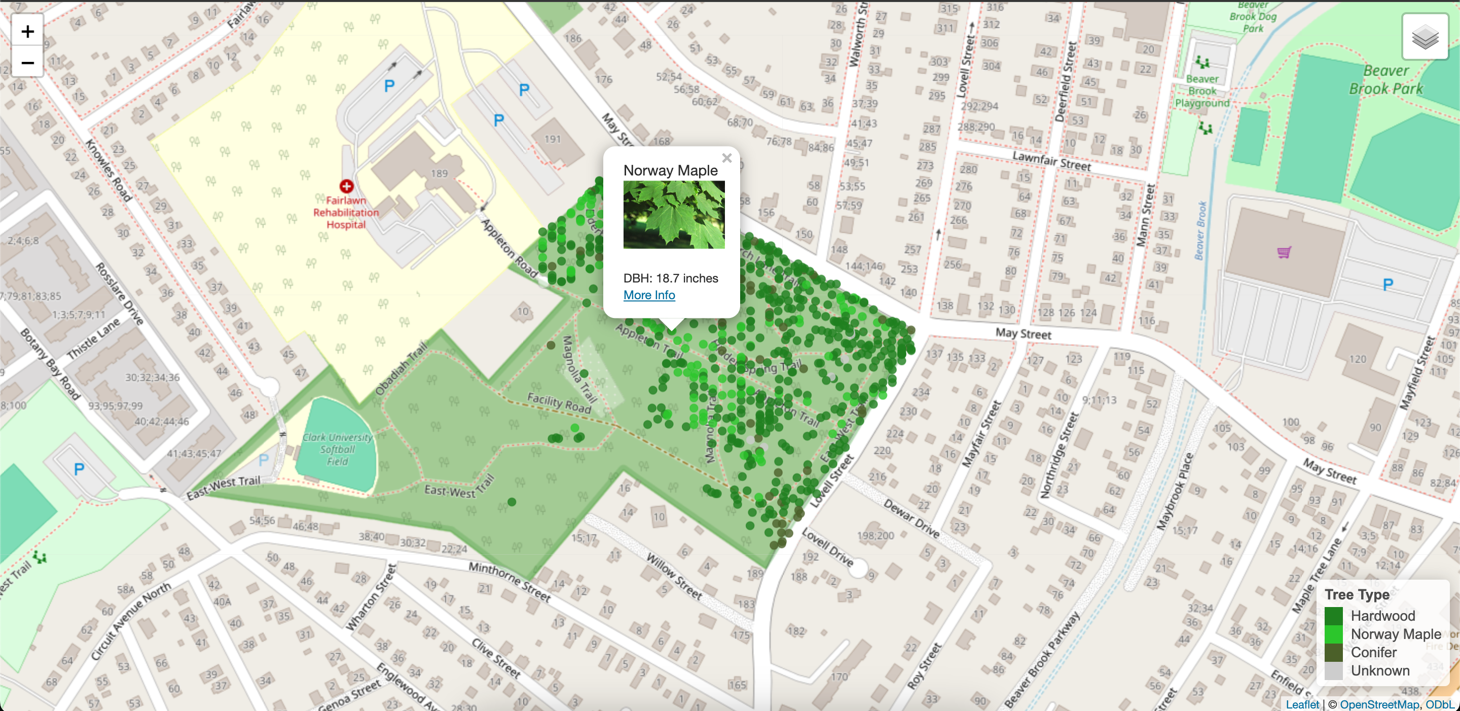
This project is a visualization of the trees in Clark University's Arboretum. This started as a final project for Geospatial Analysis with R and the team ran into issues when trying to host the webpage. Tanner took Web Mapping and Open Source GIS the following semester and was able to host the map after resolving the issues. This map utilizes web scraping to acquire the images of the trees and URLs to Clark University's website.