Team Members:
Tanner Honnef, Caleb Kluchman, Adlai Nelson, and Aaron Richmond-Crosset
Affiliation:
Project Description:
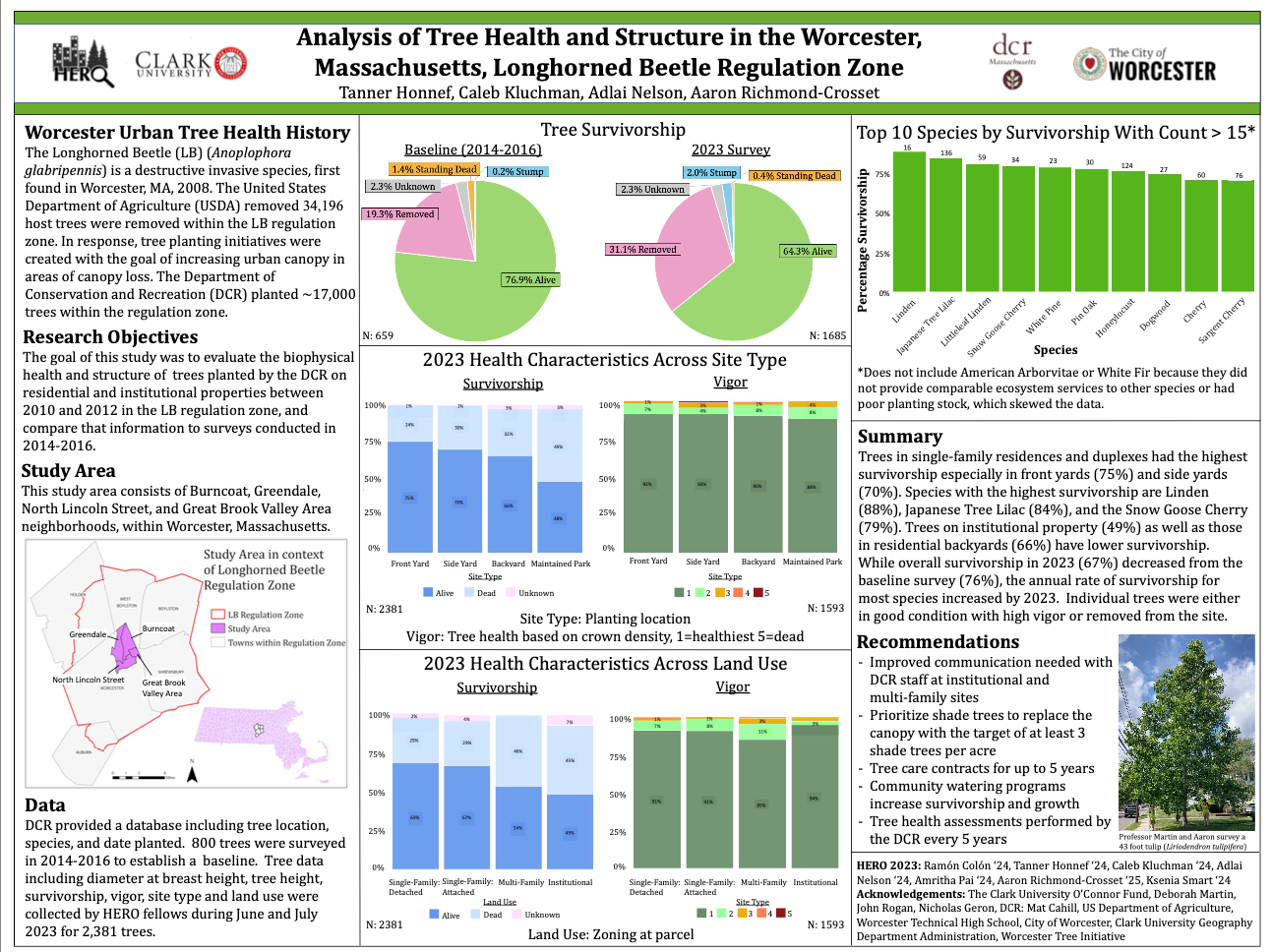
This poster is the summary of quantitative analysis collected over the summer of 2023 on the tree planting initiative in the Burncoat, Greendale, North Lincoln Street, and Great Brook Valley neighborhoods of Worcester, Massachusetts. In 2008 over 25,000 trees were cut because of a Longhorned Beetle infestation. Shortly after there was a tree planting program by the DCR. This poster summarizes the findings on the trees planted by the DCR as a part of this tree planting program. This poster was presented at NESTVAL in 2023 and won the student poster award.