Team Members:
Jason Andrews, Tanner Honnef, and Caleb Kluchman
Affiliation:
Project Description:
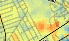
This project seeks to examine the impact of urban forestry on land surface temeperature. In 2008, the longhorned beetle infested Worcester and over 30,000 trees had to be cut down. After the cutting, there were replanting efforts to reduce urban heat and bring an urban canopy back to the area. Land Surface Temperature from landsat was used for 2007, 2009, and 2022 to compare the temperature before the cutting, after the cutting, and 12 years after the replanting.