Team Members:
Sasha Gannon, Tanner Honnef, and Iona Temple
Affiliation:
ID 296: Advanced Vector GIS
Project Description:
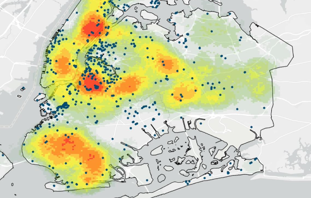
This project researched the spatial correlation between environmental justice populations and environmental remediation sites in New York City. The data for the project comes from the census while the remediation sites come from the State of New York. Point density analysis and optimized hot spot analysis were performed to determine the correlation of remediation sites and environmental justice communities. It was found that hispanic and black populations are most likely to be living near a remediation site or a remediation site which was incomplete.