Team Members:
Tanner Honnef
Affiliation:
Research under the supervision of Professor Pontius
Project Description:
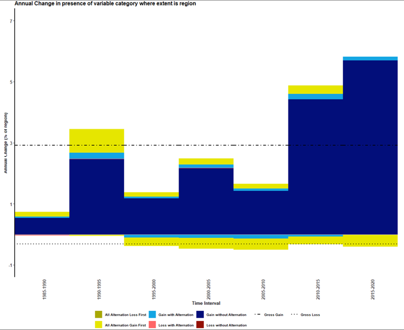
This project shows the trajectories of agriculture pixels in Bahia, Brazil from 1985-2020 in 5 year intervals. The data used is from MapBiomas. The chart on the left shows an increase in agriculture in the most recent time intervals. The R package used to run this analysis was developed by Thomas Bilintoh. Antonio Fonseca and Julia Head helped me generate these results.