Team Members:
Rory Dickinson, Wynnie Gross, Tanner Honnef, Caleb Kluchman, Saida Mousavi, Adlai Nelson, Andrew Niehaus, and Ben Spencer
Affiliation:
Wildlife Conservation Society
Project Description:
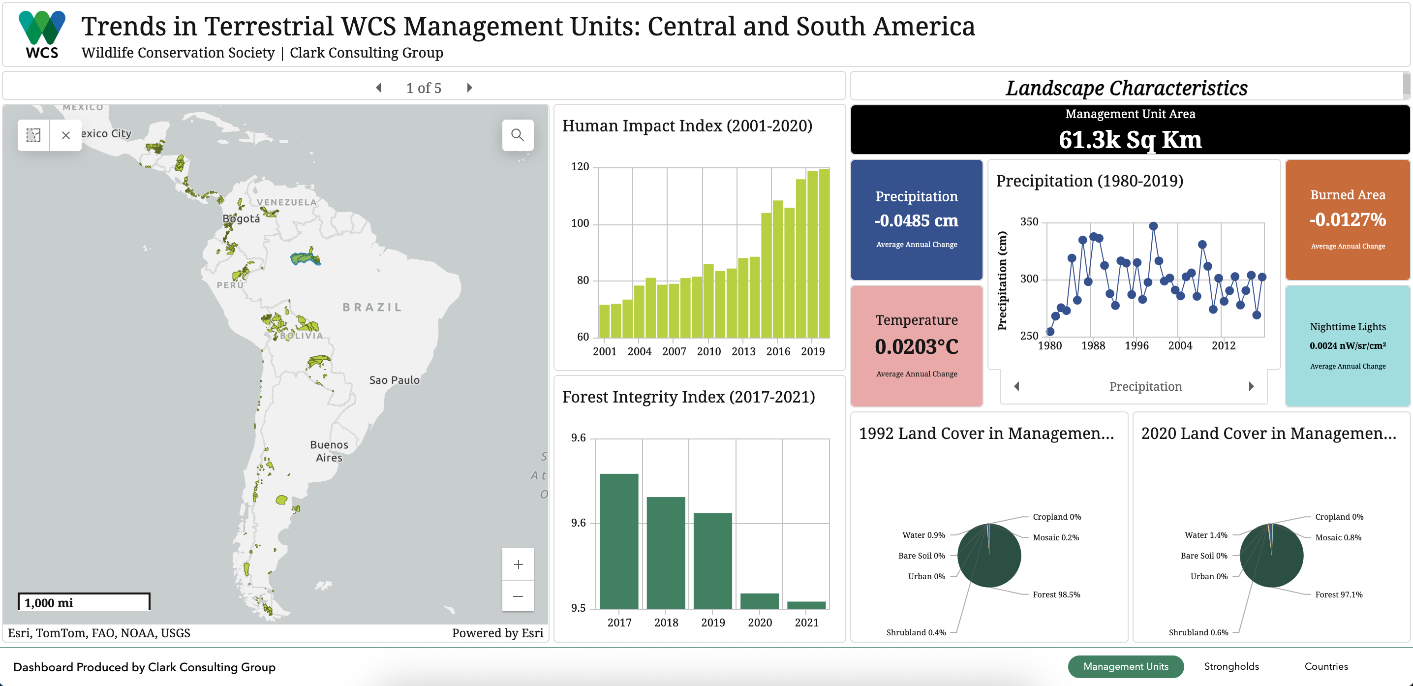
For this project, the Wildlife Conservation Society approached our professor, John Rogan, and asked us to do any analysis that we liked with thier management units. We were provided with outlines of management units and strongholds as well as Human Impact Index and Forest Landscape Integrity Index data for the management units. We decided to look at how environmental factors were changing over time within the boundaries of the management units. One of the challenges of this project was synthesizing the data in a way that would be understandable to someone who is not a GIS professional. We decided to create an ArcGIS Experience Builder which uses three ArcGIS Dashboards to show the management unit characteristics at different scales.